Last July I wrote about the Experimental Search at FamilySearch, soon after that it no longer allowed non beta testers to use it. They have now opened it up for everyone again as announced at RootsTech 2024! It may not always be available to search as they stated. I'm definitely downloading everything I find.
Right now the only US documents available for this every word search are online probate, deed records, and plantation records. Some are viewable from home, while others require you to view them at a Family History Center or Library.
This is what the Experimental Search page looked like:
You'll find the new improved Experimental Search by clicking on FamilySearch Labs View Experiments (had to clear cookies to get to the new search because I had used the old one).
This is where I found the link on my laptop. The link is on the FamilySearch homepage in the right column, on my laptop. I highlighted below where I found it.
Then you're taken to a page where you click "Expand your search with Full Text",
I've used this search to find people using names, but at this point in my research searching for deeds using a creek name or landmark has been more useful. Researching people who lived on the same creek can help you find possible relatives also living in the same area. It's also helpful in collecting neighbors' names. Those names might be useful when it comes to migration patterns.
Since I have not had access to the Experimental Search since July I have not been able to look for a new family creek location. I discovered I had the wrong creek location for my ancestor Moses Wray. I thought he lived on Maggoty Creek in Boones Mills, Franklin County, Virginia. No, he lived on a branch of that creek called White Oak Creek or White Oak Bottom Creek. When I asked about where the Wray land was when I visited the area around Maggoty Creek no one knew? If I asked around White Oak Creek they probably would have told me approximately where the Wrays lived. I'm hoping researching and plotting deeds will help me locate the precise location of the Wray land.
After listening to a Legacy Webinar I decided to start plotting deeds again.
I've been using Sandy Knoll's Metes and Bounds Software to plot the deeds I have for my Wray ancestors on White Oak Creek. I've come up with many different geometric shapes. Moses Wray left portions of his land to his sons. I've been plotting those surveys.
Here is a survey I created for one piece of their father, my ancestor, Moses Wray's land.
One of my questions is where exactly on the White Oak Bottom Creek did the family live?
Using the deeds I'm now collecting I'm sifting through them for clues to where I might find the land on a map. I might also be able to get enough information to trace land ownership to the present time so I can use a county assessor's map.
The Franklin County Settlement map has a location called White Oak Bottom, but not creek, near the Blue Ridge mountains. Moses Ray is listed farther south. Going through a current parcel map for Franklin County online I found a man with the last name Wray is living on White Oak Creek road. His land is farther south than on the Settlement Map. So was the Wray land on the creek near the Blue Ridge mountains of farther south? What area does White Oak Creek Bottom encompass?
I wondered if the Wray man was living on old Wray property. Doing some research it looks like he inherited land from his mother. His mother's family lived in the area for many generations just like the Ray family. This Wray man is a distant cousin of mine. I have not been in contact with him.
I was paging through the books looking for people living on White Oak Creek, but that is very slow. Using the Experimental Search I've found a number of deeds for people on White Oak Creek.
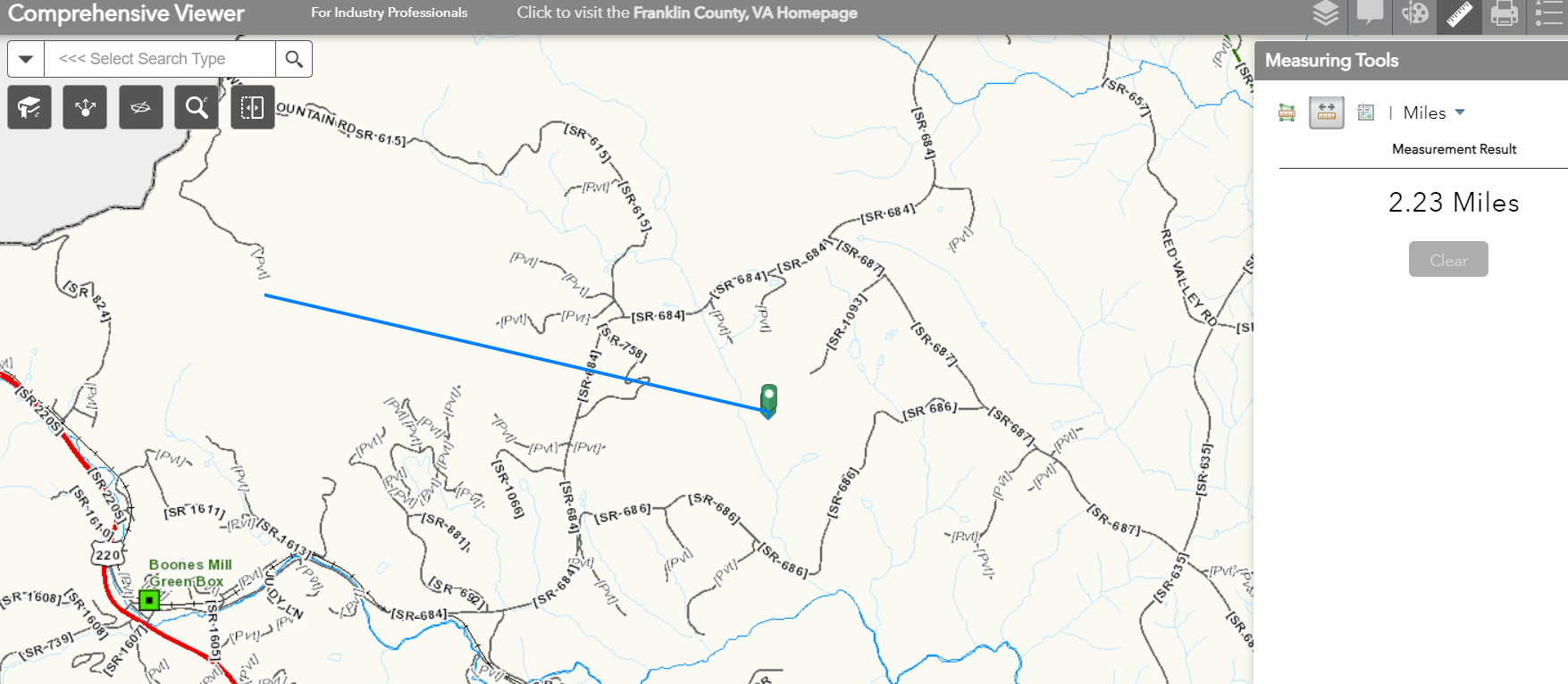
I found deeds for the family of my Wray cousin's mother's family on White Oak Creek Bottom. Measuring the distance from that land to the names on the Franklin County Settlement map their land is about two miles from White Oak Creek Bottom, and Moses Ray's land on the map.
You can see the Wray man's land outlined in blue below. You can see where it is in relation to the northern county boundary.
Yesterday I collected some of his ancestor's deeds. The deeds say his ancestor's land was on White Oak Bottom Creek. I was not sure if White Oak Bottom Creek was just the name of the bottom portion of the creek or the name of the actual creek. It appears the entire length of the creek may have been called White Oak Bottom.
The Wray man's maternal ancestor bought land on White Oak Creek in 1864. It appears to be the same land the family inherited. It also appears my Wray family land bordered the land of the Boitnott neighbors. They are not recorded as sharing a property line with this Boitnott family, but are with their neighbors. So they likely lived in that same area.
I'm planning to continue to sift through all of the deeds recording the names of people living on the creek, plotting the deed surveys, and looking at clues in the deeds regarding land locations. One of a neighbor's deeds states his land was near a place called Mead Mill. Since Franklin County was carved out of many counties I need to research the same land in parent counties.
I used "White Oak Bottom Creek" as the keywords when I searched. I then filtered the results for Virginia, by first clicking place as the United States, then clicking Virginia, and then Franklin County. Doing that I got 17 deed results.
I will continue to sift the deeds for FAN club members (friends, associates, and neighbors) for land location clues, possible migration patterns, and family living in the same area. Experiment Search is a great time saving tool for researching deeds. Important information is buried in deeds nearly impossible to find without an every word search.


No comments:
Post a Comment